Want to quickly and reliably measure road surface irregularity?
Install the ASPEN app and perform pavement condition survey using smartphone.
explore ASPEN
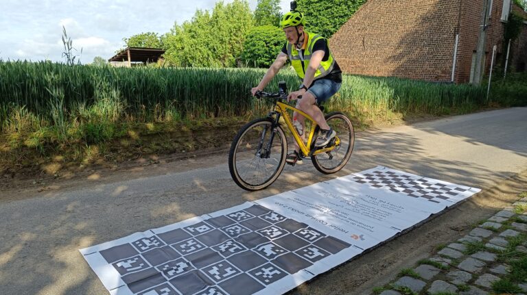
A smartphone with the ASPEN system installed on the vehicle collects data. As a measuring vehicle we use: an electric scooter, which is utlized to assess the condition of the surface of curvy and narrow sidewalks and roads for bicycles, or an ordinary car, which is used to evaluate vehicular roads.
The ASPEN app installed on a smartphone and a GoPro camera takes photographic documentation of a road corridor and assigns all images a location on the digital road network. Such images can be used for road inventory and monitoring, updating the road network model and visualizing traffic accidents on a virtual map.
ASPEN supports effective maintenance of company roads. Its accessible and comparable pavement assessment provide the road owners with reliable information on the condition of their roads and help to determine, which road sections need repair. Our experts prepare dedicated maintenance programs in line with company goals.
We will easily and quickly assess the condition of access roads leading to ongoing investments with the ASPEN system. Our clients most often monitor the condition of the infrastructure before, during and after the investment. Standard measurements can be expanded with additional images taken with a drone, which we use for in-depth analysis.
Regular pavement condition surveys enable road managers to conduct a range of analyses. Studying the changes occurring on the road network allows to create increasingly accurate degradation models, which are used in planning long-term road management strategies.
Effective road management is evidenced by the safety and comfort of its users. Information on unevenness, based on reliable data, is crucial for investment decisions made by public administrations, especially with insufficient maintenance budgets.
In addition to vibration and acceleration measurements, ASPEN records images, which are automatically located on the digital road network. The user receives images of the pavement, based on which he can determine a number of parameters, such as the width of the roadway, the location and condition of road infrastructure objects.
ASPEN recognizes the type of pavement in order to calculate the correct indicators for evaluating its technical condition. The system distinguishes between asphalt, concrete, cobblestone and dirt roads in order to assess how even the road is based on the IRI (International Roughness Index).
Without up-to-date knowledge of pavement condition, effective planning of road maintenance budgets is not possible. ASPEN results are used by road administrations in Poland and Germany to create financial plans and set investment priorities.
ASPEN does not require specialized equipment and is simple to set up, so users can take measurements on their own. Both in emergencies, when they need up-to-date data "right now", and "on the occasion" of making other rides, in order to collect information. Elementary data are sent to the system automatically after each measurement.
ASPEN is used to shield investments wherever there is a possibility of damage to road infrastructure. Up-to-date condition survey results are a valuable argument to confirm the actual road condition. Analyses compiled on their basis support risk management during the implementation of investments and will make it possible to control the wear and tear of roads in use.
ASPEN is not an alternative to classic condition survey methods. It provides results in the form of indicators that determine safety, comfort and overall condition assessment. As a result, measurement data is collected and processed much faster and the system's versatility allows it to be applied to various roads using an ordinary car and a smartphone.
Destruction of roads and their associated infrastructure can be monitored using ASPEN's convenient surveys. The system assesses the condition of the pavement and images record the infrastructure. Easily repeatable measurements, that give quick results, support road condition monitoring.
The progress of work at the construction site can be conveniently documented with the ASPEN system. The mobile application records the road corridor and image analysis allows remote monitoring of the investment process.
Performing pavement conditions surveys on a regular basis allows to collect valuable data and in-depth analysis of each road investment. ASPEN's results are presented on a map, photos, line profiles and tables, allowing engineering expertise to be carried out.


ASPEN service delivery process


news
Participation in ESA conference
On November 25-26, 2024, our colleagues Karol and Piotr participated in the European Space Agency (ESA) conference entitled “Towards a Space-Powered Economy,” […]
New standard in bicycle road diagnostics
As bicycle traffic grows, so does the awareness of single-track users, and thus their expectations of the quality of bicycle infrastructure. They […]
ESA tested ASPEN – full success!
Heller Consult have been developing the ASPEN application for surface condition evaluation of roads, sidewalks and bicycle paths for 3 years now. Read a short review of our demonstrator in Oxford.


