what is ASPEN used for?
results
basic
A basic ASPEN measurement performed by car on vehicular roads or by electric scooter on sidewalks and bicycle paths, together with photo-recording of the road corridor, yields the results as follows:
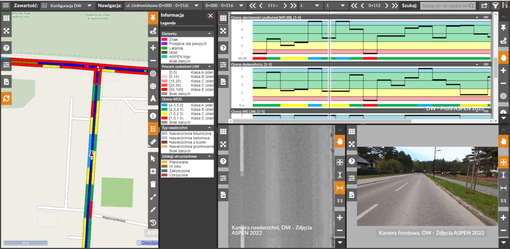
ASPEN recognizes pavement types and visualizes them on a map, profile and in a table. The system calculates where and what length each road type is located.
ASPEN calculates the International Roughness Index (IRI), which is a longitudinal evenness parameter of pavement condition commonly used by road builders.
On a scale of 1-5, we provide a discomfort rating for each surveyed road section, which we calculate based on the acceleration and vibration of the smartphone.
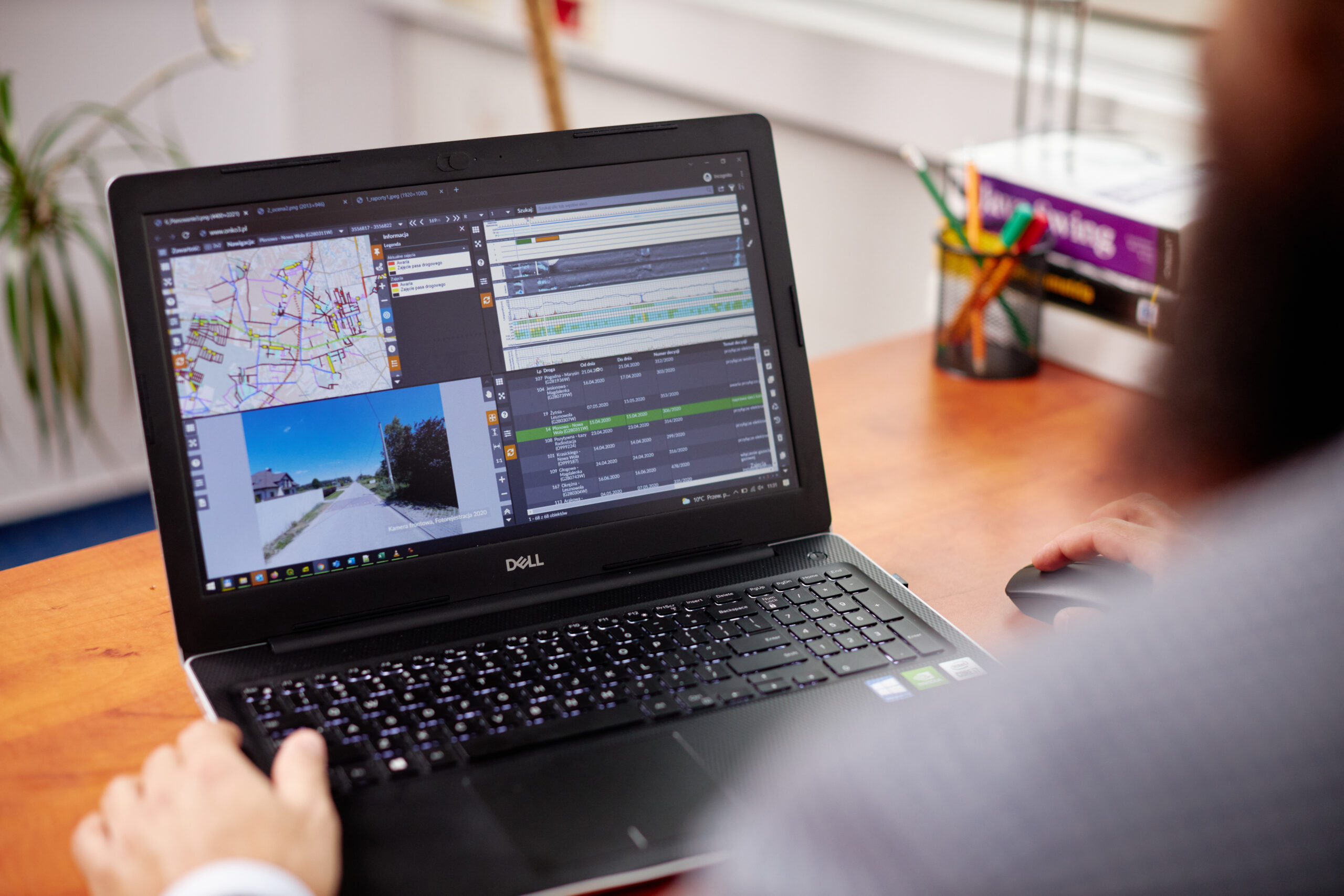
ASPEN photo reference is used to verify the digital road network.
Based on ASPEN’s results, the online data sharing system divides the road network into maintenance sections, indicating which sections require immediate repairs.
ASPEN determines an overall condition assessment based on individual indicators determined by the system.
extended
The extended option is a measurement supplemented with macro surface photos or terrain photos from a drone. The resulting data requires additional expert analysis and yields selected results:
Based on the macro photos, ASPEN identifies surface features adapted to the type and kind of road, these include patches, potholes, cracks and joints.
ASPEN’s regular diagnostics enables the development and successive calibration of pavement condition degradation models.
This is a maintenance program for roads, sidewalks or bikeways that determines which sections and in what order should be repaired to meet an organization’s quality and budget goals.
The area of the assessed traffic lane is divided into equal segments, which allows the road width to be determined at each location on the network.
With satellite localization, any road infrastructure object can be assigned to the road network model. ASPEN collects data on, among other things: horizontal and vertical markings, bus stops, pedestrian crossings, lamp posts or advertisements.
Based on images taken with a drone, we detect damage to road drainage in the area of the surveyed network, along with their location.
On the basis of images taken with the drone, we analyse the detected damage to electricity and telecommunications network poles in the area of the surveyed network, along with their location.
remote access
We present ASPEN results in an online road data sharing system.
We guarantee fast and convenient access to all information.
ASPEN features
- repeatability
- objectivity
- convenience
- versatility
- speed
- reliability